

Subhead
Nearly 12,000 Wilco buildings are in a flood plain
-
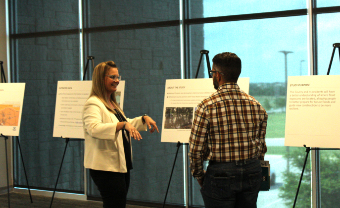
Cindy Engelhardt, left, explains how the Atlas 14 maps show rainfall data to Jarrell City Engineer Jorge L. Hernandez. Photos by Nalani Nuylan.
Cindy Engelhardt, left, explains how the Atlas 14 maps show rainfall data to Jarrell City Engineer Jorge L. Hernandez. Photos by Nalani Nuylan. -

Rob Faubion, center, answers questions from Wilco residents about the Atlas 14 preliminary results at the May 29 meeting at the Georgetown Annex. Photo by Nalani Nuylan.
Rob Faubion, center, answers questions from Wilco residents about the Atlas 14 preliminary results at the May 29 meeting at the Georgetown Annex. Photo by Nalani Nuylan.
Williamson County began hosting its public meeting series about the initial Altas 14 Flood Study results on May 29. The preliminary data shows that extreme flooding event precipitation levels have increased by two inches in a 100-year flood. This means that there is a one percent chance of extreme flooding occurring in any given year, like with a storm like Tropical Storm Hermine…